Ellicottville Mountain Biking Trail Map v1.13
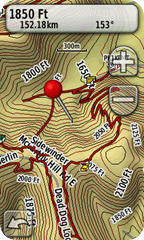
 Over the past few months, I have been slowly compiling data on the mountain biking trails around Ellicottville so that I could create a map for my Garmin GPS. This week, I stumbled across the The Ontario Trails Project which inspired me to finally pull everything together and release it to the public.
This map has a transparent background, so you can load it and it will show on top of your other maps. I would recommend Garmin’s Topo US 2008, or if you want to save some money, the excellent free NY Topo. This map is for Garmin GPS devices only and can be loaded into their free MapSource software.
A big thanks goes out to the Western New York Mountain Bicycling Association for the data and maps that they provide. They gave me a great start on this project.
Installation
DownloadEVL.1.13.zipUPDATE: v1.14 released.- Copy the contents of the ZIP file to C:\Garmin\EVL
- Navigate to C:\Garmin\EVL and double click on Ellicottville Mountain Biking.reg to install the maps into MapSource.
- If you are running 64 bit Windows, instead of #3, double click on Ellicottville Mountain Biking x64.reg to install into MapSource.
Currently, I only have the Ellicottville trails covered. I will add other areas as I get time, probably starting with Golden Hill.
Please send feedback, corrections and updates to rob (at) prouse (dot) org. You can send new trails in GPX format, but I can handle most common GPS file formats. If there is enough interest, I will try to release the maps compiled for other GPSs. I will probably also try to create a Mac version for my Apple minded friends.
The maps are for reference only and contain inaccuracies. Data for the trails comes from many sources and all have not been verified. Trails also regularly get re-routed, trails are closed and new trails are opened. I’m not responsible for how you use the data, or any inaccuracies.
Most of all, have fun and play safe.
